Take control of your commute with Google Maps
If you’ve ever been stuck on a hot, crowded train platform or caught in gridlocked traffic wishing that you could magically transport yourself to work, you know that commuting can be hard.
Why are commutes so stressful? They’re unpredictable and long. There are more than 2.2 million ‘commute’ journeys completed in Sydney1 alone each year—often resulting in a lot of stress, missed meetings, and skipped breakfasts. This equates to over 26.6 million kilometres spent commuting—which adds up to approximately 6,500 trips across Australia. And, if it is a bad commute, it can negatively impact the rest of your day, long after the actual commute is over.
Today, we’re rolling out new features on Google Maps to help you take control of your daily commute— enabling you to plan ahead, prepare for the inevitable disruptions, and possibly avoid them altogether. Oh, and we’ll also help you have a bit of fun along the way. 👍
Know before you go
Google Maps now features a commute tab that provides one-tap access to live traffic and transit information tailored to your commute. We’ll tell you if your commute is going to be a normal one or if you’ll need to budget extra time due to things like an accident or heavy traffic. In the case of a delay, we’ll tell you about alternative routes to help you get to work faster. On Android, you’ll also receive notifications about delays and disruptions on your route as they happen, so you can know about an incident before you get caught up in the delay.

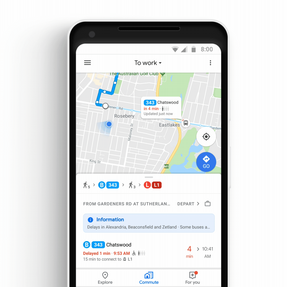
Drive🚗, walk🚶🏽, and rid 🚌: support for mixed-mode commutes
There’s a new feature for people whose commutes involve both driving and public transit. You can see helpful information about when to leave, and for each leg of your trip: you’ll know if there’s traffic on your drive, when the next train departs, and how long it’ll take to walk from the train station to the office. We do the work for you and automatically factor this into your ETA so you can anticipate exactly when you’ll get to work.
Stop the guessing game
Sprinting to the bus stop only to find that your bus is delayed is our least favourite way to start the day. Now, transit riders in 80 regions worldwide will be able to see exactly where their bus or train is in real time on the map. This will help you plan your day more efficiently—you’ll know if you can spend an extra few minutes grabbing coffee, or if you really do need to make a run for it to catch your bus. And in Sydney, we’ve partnered with Transport New South Wales to show you the occupancy of your next bus - so you’ll know whether or not you’ll get a seat. This feature will be coming to more cities around the globe soon.
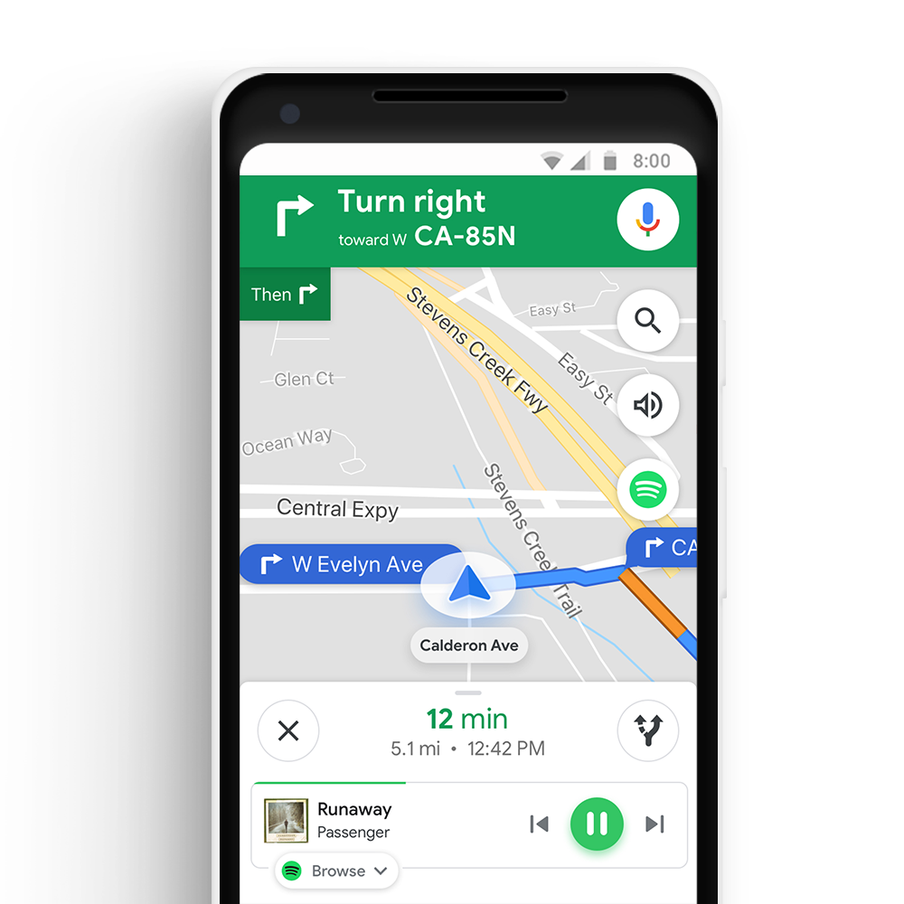
Get your motor running, head out on the highway 🎸
If you have to sit in traffic, you may as well do it while listening to good music. We're making Spotify, Apple Music, Google Play Music and YouTube Music available within Google Maps so that you can control your tunes and podcasts right from Google Maps navigation. With Spotify on Android you can also choose your favourite content by browsing through songs, albums, podcasts, and playlists with the new, easy to use navigation. Say goodbye to toggling between apps, and rock out knowing that you can keep your eyes where they should be—on the road.
Get started
Our new commute features start rolling out globally on Android and iOS this week. To get started, update your app from the Play Store or App Store. To learn how to set up your commute, visit our Help Center.
1 2016/2017, Transport for NSW, Household Travel Survey (HTS) - Data by Region↩